
Leaderboard
Popular Content
Showing content with the highest reputation on 10/06/2010 in all areas
-
I was talking to a friend of mine about riding and he suggested that the area west of Blanding Utah might be good, said some of it was quite isolated/remote and should be traveled with multiple vehicle in case you have a problem. It's south of Moab and there are some famous places there like News Paper Rock and Kane Creek which I went down and got stuck on and would do it again in a heart beat, very enjoyable!!! I plan on going there in the next month or so just to see what's there, if anyone's interested in going too, let me know. Kinarf1 point
-
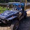
I have a problem, what do you want to do at the jamboree? Some want to test their equipment to the limits, others want to go sight seeing in a new area. While Lenny and I were out, West of Monticello, Utah, I don’t think we accomplished much, except for those who want sight see. Lenny proposed the idea of creating a route of about 100 miles which sound good, but in reality, I personally believe that’s too much. After Lenny & Jeanne headed home, Linda & I took off on a 109 mile ride. The specs are: 5:15 Moving 1:13 Stopped 6:28 Total 109.4 Miles 42.6 Max Speed 16.8 Ave. Speed This was just the two of us with no problems and one stop to eat, plus some other necessary stops, on forest roads that were nearly as smooth as pavement in a lot of places and the thing that slowed me down the most was the scenery, very beautiful, I loved the green stuff and the deep canyon stuff. My first opinion was that the jamboree might be held at or near Devils Canyon, It APPEARS to have lots of trails and set up for ATV play and has paths to long trails for the easy drivers. Right now, there are still no planned drives or places or even a good camp site. We need to find a local that can do most of the work like Devin did for the last get together. I asked Lenny for a report and here’s his report, Plus some comments to me about his trip home that I have pared down. Lenny: We went west on Highway 95 out of Blanding on around the north end of lake Powell towards Hanksville. This is one fantastic route. Outrageous scenery, but very slow going… All up and down curvy roads, but it was worth it. There is a trail south of Hanksville that I have wanted to run, so I had a chance to go by it and check it out some, didn't ride it though. We did however take a short ride on a trail we first thought was the trail I was looking for. It was a different trail. We went in only about a mile or so. Wow, perfect stuff. These aren't forest roads but old miners roads and exploration roads so they weren't put in with the idea of regular travel like forest roads. This is all canyon lands stuff but outside of the national park. The road's run the canyon and go up and down and in and out of them. It looks perfect for the Jamboree. We can do real long runs like all day ones going out and backs. Room for Rocmoc to park his monster rig too. We need to plan a trip of about 5 days to check them out properly. Maybe a few days here and a few days looking more around Blanding. This is a colder weather riding area like October or November time or maybe spring but runoff may make it impassable. The mile in we went was already lifetime memorable. You won't believe it when you see it. This has the potential of being a Jamboree that is talked about for years to come, no kidding. Until this new spot is checked out. We will have to move each night to a new camp site but, not that far and that's not to big a deal for everybody. Load up the Trooper, move and unload. Look at these trail starting points. We went on the first one and you will see a good camping area just off the road about 1/8 mile. Track the trail in for a mile or so and check the elevation changes. This is good stuff. The drive between the first and the last is some of the most beautiful scenery on earth. They won't regret the drive, I promise. Look at some google perspective views to see the terrain. N37 4.497 min W110 deg 12.452 (went into this one about a mile or until the first 200' elevation change to the top of the mesa above the canyon. An easy climb but memerable) N37 deg 41.062 min W110 deg 13.235 min N38 deg 8.495 min W110 deg 36.584 min ( this is the one I have always wanted to ride ) The trails at Blanding were more forest type roads. They are quite smooth and there are few surprises and challenges. I like some challenges and I’m not talking rock crawling challenges, I like that too, But neat stuff that makes you appreciate the Troopers capabilities. There were a few good trails but not a good network of trails where we road but there is quite a bit of area we didn’t cover. I'm looking for trails that everyone can navigate in a stock trooper and a T4 also, even though there may be a few spots that the T4 would need a bit of assistance but not much. I don't want trails that are all foot ball sized rocks either, even though there will probably be at least a bit of that on any trail. On the way home I may have found some good stuff but I'm not going to get into it until after Jeff and I check it out. All I will say is it appears to have all the making of being one of the most memorable trips you will ever take in your life, both scenery wise and ride wise. If it turns out to my expectations, all day rides packing a lunch and camera would be available. More like a Safari. The Poison Springs area goes in about 40 miles according to a write up I read where someone adventurous took their Suburban down the trail. He had to be nuts to try that but he made it. The trails are mostly smooth with occasional challenges here and there. After looking at what Lenny suggested, I would go with the Poison Spring area which is the last suggestion. 38 08 14.30 N 110 36 22.88 W @ 4932 ft, these coordinates are for the camp area. From here, there appear to be some good scenery trails to the East and some mountains to the West. My feeling is that there is enough to do at this one site to keep most happy and busy. After driving 109 miles (attachment) I would go for an extensive tour of the mountain area north of Blanding it’s scenic and easy, but not challenging. The area for the jamboree is still up in the air, Please look at these suggestion and make your suggestion and comments. My self, I enjoy the scenery of an easy road as much as the challenge of tough road. Lenny says “Your in charge so do what you think is the best” Well, If I'm President this year, then Lenny is Vice President and ALL of you are my advisers, SO ADVISE, PLEASE Kinarfi PS If you play with google earth, look at this area near Blanding, 37 48 11 N 109 35 21 W area1 point
-
No dates have been proposed by any one!!!! Here's my suggestion for the Blanding area early May, I looked at the monthly climate summary. Still planning to go preview the area, My friend suggested it, my son's inlaws go there for family reunions and Rocmoc jumped on the idea and tagged me with heading it up. Just a thought, but does any one have any interest in going there to check it out next month (HOPEFULLY) If the copied page doesn't post properly, go to http://www.wrcc.dri.edu/cgi-bin/cliMAIN.pl?utblan BLANDING, UTAH (420738) Period of Record Monthly Climate Summary Period of Record : 12/8/1904 to 12/31/2005 Jan Feb Mar Apr May Jun Jul Aug Sep Oct Nov Dec Annual Aver Max. Temp (F) 39.1 44.9 52.7 62.2 72.3 83.3 88.7 86.2 78.2 66.0 51.4 41.2 63.8 Aver Min. Temp (F) 17.2 22.3 27.8 34.3 42.1 50.7 57.9 56.2 48.3 38.0 26.7 19.2 36.7 Aver Total Precip (in.) 1.39 1.21 1.05 0.87 0.71 0.45 1.15 1.38 1.28 1.45 1.05 1.33 13.32 Ave Total Snow (in.) 10.8 7.3 4.4 1.9 0.2 0.0 0.0 0.0 0.0 0.3 3.3 9.8 38.2 Aver Snow Depth (in.) 3 2 0 0 0 0 0 0 0 0 0 1 1 Percent of possible observations for period of record. Max. Temp.: 96.1% Min. Temp.: 96.6% Precipitation: 96.9% Snowfall: 91.9% Snow Depth: 70% Kinarfi1 point
-
Thanks Rocmoc, I haven't really accepted this task yet, just seem to be doing it, guess that's good enough, but please, make suggestions or is Blanding Utah the area and we just need a date. Please post dates you would like, dates you can't go, and any good info. I have a couple of calendars in the first post, and will update them as info comes in. Kinarfi.1 point
-
Haven't made it down there yet, Hoping later to call Lenny and see if he want's to go check it out later this month or early next month. It kind of seems we have settled on this area for our Jamboree #3, does every one concur? If so, Now we need to come uo with a date.1 point
-
When I was flying, instead of crashing, I looked into the capacitive fuel gauge for my plastic tanks, it amounts to two pieces of metal, 100 sq. in. or so about 1/16 apart immersed in the gas, as the level drops, the capacitance changes and that can be measure and translated into a voltage the gauge can use. What I need is a source for the metal, ( a tube inside another tube) or an idea of how to make the capacitor, thinking about rolling two pieces of aluminum together with fish line separating them. It all needs to drop through the hole where the current gauge is. Any one have any suggestions? I think this will be my next project. Kinarfi1 point
-
Will do, and I'll add this drawing that I already have in web shots. I also think I said it all backwards. Yep, I did, reread #2 There is a magnetic float in the sender and as the gas level drops it closes the next reed switch down, then lets the upper switch open changing the resistance to ground for the gauge.1 point
-
I rebuilt rocmoc's sender quite a while back and I'm thinking to build a capacitive gauge one of these days, in the meantime, you can send yours to me and I'll rebuild for cost + postage if you want. Check your gauge by put a test light from the line going to the gauge and ground, if your test light has a small bulb in it use a tail light bulb or a quick short to ground. Should read full. At 47ohm resistor to ground is full, 77ohm is 3/4, 97 ohm is 1/2, 107 ohm is 1/4, and 110 ohm is empty. Yep, said it wrong, 3 ohms is full, 13 ohms is 3/4, 23 ohms is 1/2, 63 ohm is 1/2, 110 ohms is empty. PM me if you want. Kinarfi1 point
-
Did you mean Coral Pink Sand Dunes, what year are you thinking for the later months? Looking at those date -end of- I'd have to guess that you're going Going Camping all the Time, Trooper driving Help group. Remember, we're here for you when you need us!! kinarfi1 point
This leaderboard is set to New York/GMT-04:00