
-
Similar Topics
-
 By jertex
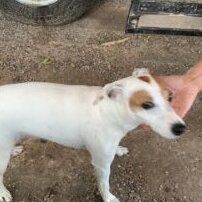
I bought a 2017 Stampede 900 last fall that was new, old stock with less than 5 hours on it thinking that I would be getting a relatively trouble free UTV as compared to buying a used Polaris or CanAm, or Honda, etc. It's been a little quirky, but reliable. What I thought was just a minor issue with this model, the difficulty in shifting between R, N, L, H, etc., was just a characteristic of this model is now a big problem. I had to climb two very steep trails to get to the upper meadow of our hunting property, which seemed to stress the UTV more than usual since I was carrying some lumber to work on a platform for a hunting blind, and when I went to shift into park, I felt something give and it would not shift out of low, but it did move up into high gear. I couldn't get it to shift at all at that point and the shifter felt mushy for lack of a better word. I was able to get it down to the lodge and when I investigated, I discovered that the straight, metal tube portion of the shift cable had bent to almost 90 degrees (see pics). I'm positive that it had already had some deformation that had happened previously and it had the right amount of resistance to bend to the point where it was unusable.
I have two questions:
1. I suspect that there must be some other issues that makes this UTV difficult to shift, and I'm wondering if this is a common problem and if someone could enlighten me on what could cause this to be difficult to shift?
2. Have any of you had this happen and if so, how difficult is it to replace the shifter cable?
Any other advice is welcome, this is the first UTV that I've ever owned, so I don't know much about working on these or maintaining them. I'm relatively capable when it comes to working on my own vehicles in general, and I'm not afraid to take things apart and get my hands dirty.
Thanks in advance for any insight, I'll be traveling most the day so I won't get a chance to look at replies until this evening.
-
 By OBL
program will open in old Bud program only/ but will not go in BUDS 2 to let use program ECU problem working on has new engine/ new fuel pump/ injectors/ lines/ sensors/ crank sensor maps/ and new throttle body and injectors. machine starts runs a minute dies/ on 3 rd try says key not recognized /we put other key in and same thing happens/wait 10 minutes, you can go again/ is there a back door in the program/ also might mention unplug temp sensor and map sensor , it will run a few minutes longer / then die again.
-
 By Firewalker918
I have a 2021 UV34XL and I am kind of looking to change it up from the orange wheels and maybe do a wrap? Please share photos of any XLs that has been modified to look better and any seat covers recommended.thanks
-
 By jon pino
having trouble with a 2013 uxv500i. have replaced stator due to bad pulser coil. new unit does not work. manual value for pulser coil is 100ish ohm, measured value is 500 ohm. can anyone with one of these fuel injected later model units check their pulser coil with an ohm meter for me? left side of engine small connector next to 3 yellows. jon 605-545-7040
-
 By jamesxevan
I’ve been eyeing a Hisun 500 soft cab enclosure upper doors setup for my UTV, but I’m really not sure if it’s a smart move. The idea of doors and some protection sounds appealing, but I worry they might just be a flimsy afterthought — weak zippers, thin plastic windows, maybe leaking or fogging when wet or cold. What good is “protection” if it doesn’t seal well? Also concerned about ventilation: with soft doors, does the cab get too muggy or stuffy?
Anyone here use soft-cab doors on a Hisun 500 — did they actually hold up for real riding conditions, or did you end up ditching them for hard doors (or no doors)?
-

Recommended Posts
Join the conversation
You can post now and register later. If you have an account, sign in now to post with your account.
Note: Your post will require moderator approval before it will be visible.